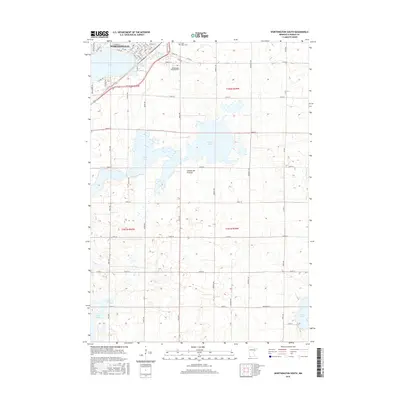
2016 Map of Worthington South
USGS Topo · Published 2016About this map
The southern portion of Worthington anchors this 2016 survey, where the street grid of the city meets the agricultural expanses of Nobles County. Resting on the distinctive Coteau des Prairies upland, the landscape is defined by its glacial lakes, including the large Okabena Lake at the city's edge and the expansive Ocheda Lake to the southeast. These water bodies, along with Lake Bella and Indian Lake near the state line, dictate the local drainage and transportation patterns. Genealogists and historians will find significant landmarks such as Saint Marys Cem and the Worthington Township Cem clearly situated among the townships of T101N and T102N. The map details the transition from urban infrastructure, like State Hwy 60 and Lake Ave, into a strictly partitioned rural network of range and section lines.
Find a feature on this map
59 named features on this map. Tap any name to fly to it.
Don’t see what you’re looking for? This feature index may not catch every label — zoom into the map to look around manually.
Map Details
Editions of this 2016 Worthington South Map
This is the sole edition of this map. No revisions or reprints were ever made.
Other maps of this area

1954 · Fairmont
USGS Topo · 1:250,000

1958 · Fairmont
USGS Topo · 1:250,000

1960 · Brewster
USGS Topo · 1:24,000

1960 · Reading
USGS Topo · 1:24,000

1960 · Bigelow
USGS Topo · 1:24,000

1960 · Worthington North
USGS Topo · 1:24,000

1960 · Worthington South
USGS Topo · 1:24,000

1960 · Round Lake
USGS Topo · 1:24,000

1970 · Harris
USGS Topo · 1:24,000

1972 · Ocheyedan
USGS Topo · 1:24,000