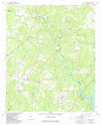
1964 Map of Worthville
USGS Topo · Published 1985About this map
South River and the Yellow River converge in this mid-century look at the Newton and Butts county border, just as they flow into the northern reaches of Jackson Lake. The landscape is defined by its rural density, centered on the unincorporated settlements of Worthville and Fincherville. The distribution of community life is anchored by a network of rural congregations and burial grounds, including Oak Grove Ch and Sardis Ch, which sit along the many drainage branches like Mackey Creek and Shot Bag Branch.
Find a feature on this map
40 named features on this map. Tap any name to fly to it.
Don’t see what you’re looking for? This feature index may not catch every label — zoom into the map to look around manually.
Map Details
Editions of this 1964 Worthville Map
2 editions found

Other maps of this area

1888 · Atlanta
USGS Topo · 1:125,000

1890 · Atlanta
USGS Topo · 1:125,000

1892 · Atlanta
USGS Topo · 1:125,000

1895 · Atlanta
USGS Topo · 1:125,000

1896 · Monroe
USGS Topo · 1:125,000

1953 · Atlanta
USGS Topo · 1:250,000

1953 · Athens
USGS Topo · 1:250,000

1957 · Atlanta
USGS Topo · 1:250,000

1958 · Athens
USGS Topo · 1:250,000

1958 · Atlanta
USGS Topo · 1:250,000