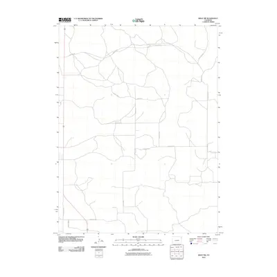
2010 Map of Wray NW
USGS Topo · Published 2010About this map
Yuma County's high plains landscape is defined by an extensive grid of section-line roads in this 2010 survey of the Wray area. The map illustrates a rural transport network characterized by long, straight stretches such as County Road NN and County Road PP, which navigate the subtle topographic changes of the eastern Colorado prairie. Unlike many mountainous regions of the state, this area shows a highly organized, rectangular survey system typical of the Great Plains, where routes like County Rd 45 and County Rd 42 provide access to agricultural lands. The density of these named county roads indicates an active farming or ranching environment, where property boundaries and travel corridors have remained largely consistent since the original homesteading era.
Find a feature on this map
11 named features on this map. Tap any name to fly to it.
Don’t see what you’re looking for? This feature index may not catch every label — zoom into the map to look around manually.
Map Details
Editions of this 2010 Wray NW Map
This is the sole edition of this map. No revisions or reprints were ever made.
Other maps of this area

1954 · Sterling
USGS Topo · 1:250,000

1958 · Sterling
USGS Topo · 1:250,000

1961 · Robb
USGS Topo · 1:24,000

1961 · Laird
USGS Topo · 1:24,000

1961 · Wray
USGS Topo · 1:24,000

1971 · Alvin SW
USGS Topo · 1:24,000

1971 · Alvin
USGS Topo · 1:24,000

1971 · Wauneta
USGS Topo · 1:24,000

1971 · Wray NE
USGS Topo · 1:24,000

1971 · Eckley NE
USGS Topo · 1:24,000