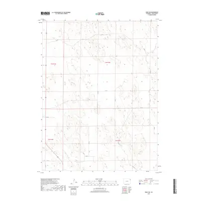
2019 Map of Wray NW
USGS Topo · Published 2019About this map
High plains grazing land and section-line roads dominate this 2019 survey of northeastern Colorado. The landscape is characterized by a grid-like network of rural routes, including Co Rd 45 and Co Rd 42, which facilitate movement across the arid terrain of t3n r44w and t3n r43w. The map preserves a record of regional land use, specifically through the presence of the Cattle Trl in the southern portion of the quadrangle. This feature highlights the ongoing importance of the ranching economy and livestock movement in Yuma County. Other local corridors such as Co Rd Kk and Co Rd Ll provide a detailed view of the infrastructure supporting this sparsely populated agricultural area near the state border.
Find a feature on this map
14 named features on this map. Tap any name to fly to it.
Don’t see what you’re looking for? This feature index may not catch every label — zoom into the map to look around manually.
Map Details
Editions of this 2019 Wray NW Map
This is the sole edition of this map. No revisions or reprints were ever made.
Other maps of this area

1954 · Sterling
USGS Topo · 1:250,000

1958 · Sterling
USGS Topo · 1:250,000

1961 · Robb
USGS Topo · 1:24,000

1961 · Laird
USGS Topo · 1:24,000

1961 · Wray
USGS Topo · 1:24,000

1971 · Alvin SW
USGS Topo · 1:24,000

1971 · Alvin
USGS Topo · 1:24,000

1971 · Wauneta
USGS Topo · 1:24,000

1971 · Wray NE
USGS Topo · 1:24,000

1971 · Eckley NE
USGS Topo · 1:24,000