
1966 Map of Wren
USGS Topo · Published 1967About this map
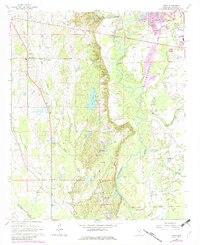
The Indian Treaty Boundary cuts across the northeastern portion of this Monroe County landscape, serving as a reminder of the region's complex history before 1960s development. The Tombigbee River meanders through the eastern section, flanked by numerous gravel pits and the oxbow-like Moccasin Slough. Central to the map is Lake Monroe, situated amongst the timbered ridges where a Lookout Tower and Radio Tower stand as local landmarks. Rural life in and around Wren and New Wren is well-documented through a high density of small country churches and cemeteries, including Grady's Chapel, Tranquil Ch, and the Masonic Cemetery. Transportation and utility infrastructure are clearly visible, from the Amory Airport and local pipeline to the Old Railroad Grade that speaks to the area's changing connectivity as the mid-century progressed.
Find a feature on this map
39 named features on this map. Tap any name to fly to it.
Don’t see what you’re looking for? This feature index may not catch every label — zoom into the map to look around manually.
Map Details
Editions of this 1966 Wren Map
2 editions found
Other maps of this area

1953 · West Point
USGS Topo · 1:250,000

1956 · Tupelo
USGS Topo · 1:250,000

1958 · Tupelo
USGS Topo · 1:250,000

1958 · West Point
USGS Topo · 1:250,000

1963 · West Point
USGS Topo · 1:250,000

1965 · Egypt
USGS Topo · 1:24,000

1966 · Smithville
USGS Topo · 1:24,000

1966 · Aberdeen
USGS Topo · 1:24,000

1966 · Shannon
USGS Topo · 1:24,000

1966 · Amory
USGS Topo · 1:24,000