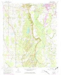
1966 Map of Wren
USGS Topo · Published 1982About this map
Tombigbee River meanders through this Monroe County landscape, defining the transition between the rolling hills to the west and the bottomlands of Moccasin Slough to the east. The settlement of Wren and its counterpart New Wren serve as focal points for a rural community connected by a network of country churches and family burying grounds. Small congregations such as Mt Olive Ch, New Hope Ch, and Grace Chapel are scattered across the terrain, reflecting the deep-rooted local history of the region.
Find a feature on this map
40 named features on this map. Tap any name to fly to it.
Don’t see what you’re looking for? This feature index may not catch every label — zoom into the map to look around manually.
Map Details
Editions of this 1966 Wren Map
2 editions found

Other maps of this area

1953 · West Point
USGS Topo · 1:250,000

1956 · Tupelo
USGS Topo · 1:250,000

1958 · Tupelo
USGS Topo · 1:250,000

1958 · West Point
USGS Topo · 1:250,000

1963 · West Point
USGS Topo · 1:250,000

1965 · Egypt
USGS Topo · 1:24,000

1966 · Smithville
USGS Topo · 1:24,000

1966 · Aberdeen
USGS Topo · 1:24,000

1966 · Shannon
USGS Topo · 1:24,000

1966 · Amory
USGS Topo · 1:24,000