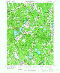
1964 Map of Wrentham
USGS Topo · Published 1966About this map
Institutional presence and sprawling state lands define this mid-1960s landscape between Wrentham and Foxboro. Large parcels are dedicated to the State Prison Reservation, the Massachusetts Correctional Institute at Walpole, and Pondville State Hospital. These facilities are integrated into a patchwork of woodland and wetlands, including the Cedar Swamp and the Foxborough State Forest. The era's recreational and cultural shift is visible through the Bay State Raceway, a Drive-in Theater, and various country clubs and golf courses.
Find a feature on this map
146 named features on this map. Tap any name to fly to it.
Don’t see what you’re looking for? This feature index may not catch every label — zoom into the map to look around manually.
Map Details
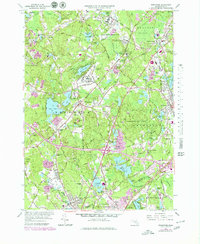
Editions of this 1964 Wrentham Map
2 editions found
Other maps of this area

1885 · Taunton
USGS Topo · 1:62,500

1886 · Dedham
USGS Topo · 1:62,500

1887 · Franklin
USGS Topo · 1:62,500

1887 · Providence
USGS Topo · 1:62,500

1888 · Taunton
USGS Topo · 1:62,500

1889 · Providence
USGS Topo · 1:62,500

1889 · Franklin
USGS Topo · 1:62,500

1893 · Taunton
USGS Topo · 1:62,500

1893 · Franklin
USGS Topo · 1:62,500

1894 · Dedham
USGS Topo · 1:62,500