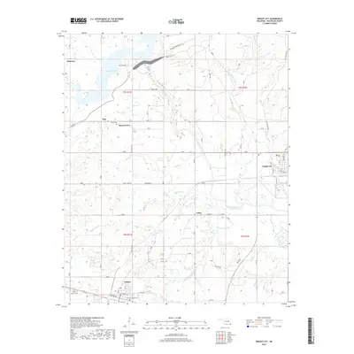
2018 Map of Wright City
USGS Topo · Published 2018About this map
Wright City and the neighboring settlement of Valliant anchor this survey of McCurtain County, where the southern Oklahoma timberlands meet the winding course of the Little River. The landscape is defined by the significant waters of Pine Creek Lake to the northwest, feeding into the river system alongside numerous tributaries such as Cypress Creek and White-Oak Creek. Smaller rural hubs like Slim, Felker, and Mound Grove dot the countryside, connected by local routes such as Rufe Road and Pine Creek Road. Local history and genealogy are evidenced by the presence of the Moran Cemetery and the two burial grounds in Valliant, Valliant Cemetery and Valliant-Uptown Cemetery. The area's transit patterns are reflected in the grid of Wright City, where Railroad Street suggests the community's historical reliance on the rail lines that served the regional lumber industry.
Find a feature on this map
57 named features on this map. Tap any name to fly to it.
Don’t see what you’re looking for? This feature index may not catch every label — zoom into the map to look around manually.
Map Details
Editions of this 2018 Wright City Map
This is the sole edition of this map. No revisions or reprints were ever made.
Other maps of this area

1901 · Alikchi
USGS Topo · 1:125,000

1902 · Lukfata
USGS Topo · 1:125,000

1950 · Mcalester
USGS Topo · 1:250,000

1951 · Garvin
USGS Topo · 1:24,000

1951 · Millerton
USGS Topo · 1:24,000

1951 · Kiomatia
USGS Topo · 1:24,000

1953 · Texarkana
USGS Topo · 1:250,000

1956 · Texarkana
USGS Topo · 1:250,000

1959 · Golden
USGS Topo · 1:62,500

1962 · McAlester
USGS Topo · 1:250,000