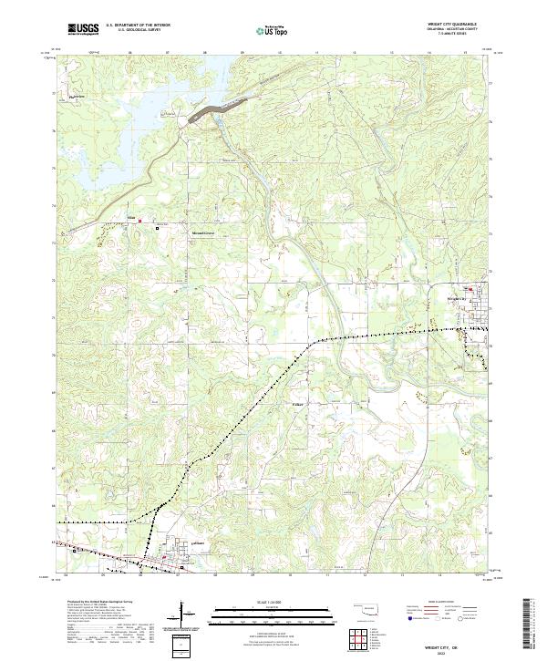
2022 Map of Wright City
USGS Topo · Published 2022About this map
Wright City and the neighboring community of Valliant anchor the southeast and southwest corners of this McCurtain County landscape. The area is defined by the winding course of the Little River, which receives numerous tributaries including Cypress Creek, Pine Creek, and White Oak Cr. The map shows a transition from the gridded street plans of the larger towns to more dispersed settlements such as Mound Grove, Plainview, and Slim.
Find a feature on this map
37 named features on this map. Tap any name to fly to it.
Don’t see what you’re looking for? This feature index may not catch every label — zoom into the map to look around manually.
Map Details
Editions of this 2022 Wright City Map
This is the sole edition of this map. No revisions or reprints were ever made.
Other maps of this area

1901 · Alikchi
USGS Topo · 1:125,000

1902 · Lukfata
USGS Topo · 1:125,000

1950 · Mcalester
USGS Topo · 1:250,000

1951 · Garvin
USGS Topo · 1:24,000

1951 · Millerton
USGS Topo · 1:24,000

1951 · Kiomatia
USGS Topo · 1:24,000

1953 · Texarkana
USGS Topo · 1:250,000

1956 · Texarkana
USGS Topo · 1:250,000

1959 · Golden
USGS Topo · 1:62,500

1962 · McAlester
USGS Topo · 1:250,000