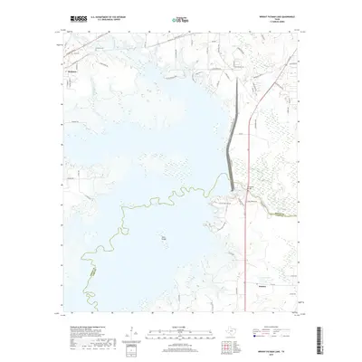
2019 Map of Wright Patman Lake
USGS Topo · Published 2019About this map
Wright Patman Lake dominates the central landscape of this East Texas survey, where the waters of the Sulphur River are held back near the Bowie and Cass county lines. The settlement of Redwater sits to the northwest, defined by a network of residential roads like Piney Ridge Rd and Hollaway Cem, providing a clear record of local family geography. To the southeast, the small community of Domino is situated near Caver Lake, illustrating the rural settlement patterns that persist along the river corridor.
Find a feature on this map
67 named features on this map. Tap any name to fly to it.
Don’t see what you’re looking for? This feature index may not catch every label — zoom into the map to look around manually.
Map Details
Editions of this 2019 Wright Patman Lake Map
This is the sole edition of this map. No revisions or reprints were ever made.
Other maps of this area

1907 · Atlanta
USGS Topo · 1:62,500

1909 · New Boston
USGS Topo · 1:62,500

1909 · Texarkana
USGS Topo · 1:62,500

1910 · Linden
USGS Topo · 1:62,500

1910 · Atlanta
USGS Topo · 1:62,500

1953 · Texarkana
USGS Topo · 1:250,000

1954 · Texarkana
USGS Topo · 1:24,000

1954 · Domino
USGS Topo · 1:24,000

1954 · Leary
USGS Topo · 1:24,000

1954 · Hooks
USGS Topo · 1:24,000