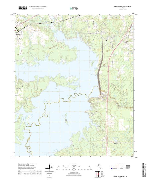
2022 Map of Wright Patman Lake
USGS Topo · Published 2022About this map
Wright Patman Lake dominates this modern landscape on the boundary of Bowie Co and Cass Co, Texas. The expansive reservoir covers much of the central terrain, punctuated by features like Bells Island and the elevated Coal Stone Bluff overlooking the Sulphur River channel below the dam. To the northwest, the settlement of Redwater is visible with its local institutions, including Redwater Cem and Hollaway Cem. The southeastern corner shows the community of Domino near the wetland-rich area of Caver Lake. This survey illustrates the contrast between the heavily managed waters of the lake and the surviving rural road networks, such as Piney Ridge Rd and Poor Boy Rd, that serve the scattered homesteads and recreational areas like Clear Springs Park.
Find a feature on this map
71 named features on this map. Tap any name to fly to it.
Don’t see what you’re looking for? This feature index may not catch every label — zoom into the map to look around manually.
Map Details
Editions of this 2022 Wright Patman Lake Map
This is the sole edition of this map. No revisions or reprints were ever made.
Other maps of this area

1907 · Atlanta
USGS Topo · 1:62,500

1909 · New Boston
USGS Topo · 1:62,500

1909 · Texarkana
USGS Topo · 1:62,500

1910 · Linden
USGS Topo · 1:62,500

1910 · Atlanta
USGS Topo · 1:62,500

1953 · Texarkana
USGS Topo · 1:250,000

1954 · Texarkana
USGS Topo · 1:24,000

1954 · Domino
USGS Topo · 1:24,000

1954 · Leary
USGS Topo · 1:24,000

1954 · Hooks
USGS Topo · 1:24,000