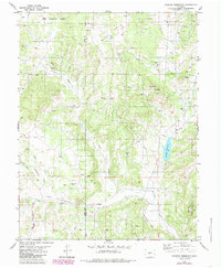
1983 Map of Wrights Reservoir
USGS Topo · Published 1985About this map
Wrights Reservoir serves as a central landmark in this high-altitude landscape along the border of Park and Teller counties. Surveyed in the mid-1970s and updated in the early 1980s, the map reveals a remote ranching and mining terrain defined by the drainage of Fourmile Creek. The presence of Fourmile Ch and Fourmile Cem indicates a localized community center, while numerous small mining sites like the Prospects near Dog Head and various Quarry locations suggest a history of resource extraction.
Find a feature on this map
35 named features on this map. Tap any name to fly to it.
Don’t see what you’re looking for? This feature index may not catch every label — zoom into the map to look around manually.
Map Details
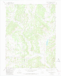
Editions of this 1983 Wrights Reservoir Map
2 editions found
Other maps of this area

1894 · Pikes Peak
USGS Topo · 1:125,000

1901 · Pikes Peak
USGS Topo · 1:125,000

1901 · Pikes Peak
USGS Topo · 1:62,500

1942 · Cover Mtn.
USGS Topo · 1:62,500

1948 · Cover Mtn.
USGS Topo · 1:62,500

1951 · Cripple Creek South
USGS Topo · 1:24,000

1951 · Cripple Creek North
USGS Topo · 1:24,000

1954 · Divide
USGS Topo · 1:24,000

1954 · Pueblo
USGS Topo · 1:250,000

1956 · Lake George
USGS Topo · 1:24,000