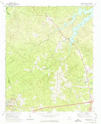
1972 Map of Wrightsboro
USGS Topo · Published 1975About this map
Wrightsboro occupies the central portion of this 1970s landscape, situated at a junction of rural roads and historical waterways. The terrain is defined by a dense network of drainages including Hart Creek, Little Creek, and Mattox Creek, all contributing to the southern reaches of Clark Hill Lake. The map reveals a community structured around its spiritual and social anchors, such as Brinkley Chapel, New Zion Hill Ch, and Pine Grove Ch. Evidence of local industry and infrastructure is present in the Quarry near Cedar Rock and the expansion of the Thomson Airport. A notable transition in land use is visible at the Belle Meade Country Club, while the presence of a Lookout Tower and an Industrial Waste Pond indicates the diverse economic activities of McDuffie County during this era.
Find a feature on this map
26 named features on this map. Tap any name to fly to it.
Don’t see what you’re looking for? This feature index may not catch every label — zoom into the map to look around manually.
Map Details
Editions of this 1972 Wrightsboro Map
3 editions found
Other maps of this area

1892 · Mc Cormick
USGS Topo · 1:125,000

1906 · Crawfordville
USGS Topo · 1:125,000

1912 · Mc Cormick
USGS Topo · 1:125,000

1921 · Appling
USGS Topo · 1:62,500

1922 · Harlem
USGS Topo · 1:62,500

1943 · Appling
USGS Topo · 1:62,500

1948 · Harlem
USGS Topo · 1:62,500

1948 · Thomson East
USGS Topo · 1:24,000

1950 · Dearing
USGS Topo · 1:24,000

1953 · Athens
USGS Topo · 1:250,000