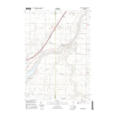
2016 Map of Wrightstown
USGS Topo · Published 2016About this map
The Fox River serves as the central artery for this region of eastern Wisconsin, dividing the settlements of Wrightstown and Kaukauna. This survey captures the rural landscape at a time of established township grids and modern infrastructure, where the boundary between Outagamie Co and Brown Co meets at the river's edge. The distribution of local landmarks, such as the Antique Aerodrome near the northern border, reflects the diverse land use of the mid-2010s.
Find a feature on this map
115 named features on this map. Tap any name to fly to it.
Don’t see what you’re looking for? This feature index may not catch every label — zoom into the map to look around manually.
Map Details
Editions of this 2016 Wrightstown Map
This is the sole edition of this map. No revisions or reprints were ever made.
Other maps of this area

1911 · Neenah
USGS Topo · 1:62,500

1954 · De Pere
USGS Topo · 1:62,500

1954 · De Pere
USGS Topo · 1:24,000

1954 · Chilton
USGS Topo · 1:62,500

1955 · Neenah
USGS Topo · 1:62,500

1955 · Appleton
USGS Topo · 1:62,500

1955 · Green Bay
USGS Topo · 1:250,000

1974 · Hilbert
USGS Topo · 1:24,000

1974 · Brillion
USGS Topo · 1:24,000

1974 · Kaukauna
USGS Topo · 1:24,000