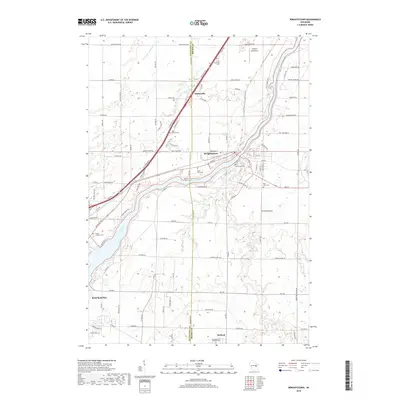
2018 Map of Wrightstown
USGS Topo · Published 2018About this map
The Fox River cuts a prominent diagonal across this landscape, serving as a historic corridor for the settlements of Wrightstown, Sniderville, and the northern edge of Kaukauna. This survey captures the modern rural and suburban character of the area where the Outagamie and Brown County line meets. A high concentration of religious and genealogical sites is evident throughout the terrain, including Saint Patrick Cem, Riverside Cem, and Saint Johns Cem. The local infrastructure is defined by a dense grid of named country roads and the convergence of waterways like Apple Creek and Plum Cr. To the northeast, the Antique Aerodrome sits near the winding path of the East River, while the southern portion of the sheet transitions toward the quiet community of Holland and its namesake Saint Francis Catholic Cemetery.
Find a feature on this map
112 named features on this map. Tap any name to fly to it.
Don’t see what you’re looking for? This feature index may not catch every label — zoom into the map to look around manually.
Map Details
Editions of this 2018 Wrightstown Map
This is the sole edition of this map. No revisions or reprints were ever made.
Other maps of this area

1911 · Neenah
USGS Topo · 1:62,500

1954 · De Pere
USGS Topo · 1:62,500

1954 · De Pere
USGS Topo · 1:24,000

1954 · Chilton
USGS Topo · 1:62,500

1955 · Neenah
USGS Topo · 1:62,500

1955 · Appleton
USGS Topo · 1:62,500

1955 · Green Bay
USGS Topo · 1:250,000

1974 · Hilbert
USGS Topo · 1:24,000

1974 · Brillion
USGS Topo · 1:24,000

1974 · Kaukauna
USGS Topo · 1:24,000