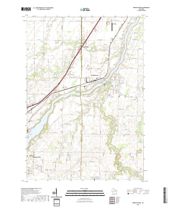
2022 Map of Wrightstown
USGS Topo · Published 2022About this map
The Fox River carves a deep valley through the center of this landscape, acting as the primary artery for the village of Wrightstown. The settlement pattern follows the river's path and the intersection of major county routes, with residential growth concentrated near the historic river crossing. Just to the north, the small community of Sniderville sits at a crossroads, while the northern edge of Kaukauna appears at the southwestern corner.
Find a feature on this map
115 named features on this map. Tap any name to fly to it.
Don’t see what you’re looking for? This feature index may not catch every label — zoom into the map to look around manually.
Map Details
Editions of this 2022 Wrightstown Map
This is the sole edition of this map. No revisions or reprints were ever made.
Other maps of this area

1911 · Neenah
USGS Topo · 1:62,500

1954 · De Pere
USGS Topo · 1:62,500

1954 · De Pere
USGS Topo · 1:24,000

1954 · Chilton
USGS Topo · 1:62,500

1955 · Neenah
USGS Topo · 1:62,500

1955 · Appleton
USGS Topo · 1:62,500

1955 · Green Bay
USGS Topo · 1:250,000

1974 · Hilbert
USGS Topo · 1:24,000

1974 · Brillion
USGS Topo · 1:24,000

1974 · Kaukauna
USGS Topo · 1:24,000