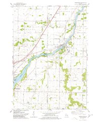
1974 Map of Wrightstown
USGS Topo · Published 1978About this map
The Fox River carves a deep valley through this mid-1970s landscape, serving as the central artery for the village of Wrightstown. The river's industrial and hydro-electric history is evident at the Rapide Croche Dam, while the presence of Industrial Waste Ponds reflects the era's manufacturing footprint. Beyond the riverbanks, the terrain transitions into agricultural land and suburban pockets like Sniderville, crisscrossed by the Chicago and Northwestern railroad line.
Find a feature on this map
46 named features on this map. Tap any name to fly to it.
Don’t see what you’re looking for? This feature index may not catch every label — zoom into the map to look around manually.
Map Details
Editions of this 1974 Wrightstown Map
This is the sole edition of this map. No revisions or reprints were ever made.
Other maps of this area

1911 · Neenah
USGS Topo · 1:62,500

1954 · De Pere
USGS Topo · 1:62,500

1954 · De Pere
USGS Topo · 1:24,000

1954 · Chilton
USGS Topo · 1:62,500

1955 · Neenah
USGS Topo · 1:62,500

1955 · Appleton
USGS Topo · 1:62,500

1955 · Green Bay
USGS Topo · 1:250,000

1974 · Hilbert
USGS Topo · 1:24,000

1974 · Brillion
USGS Topo · 1:24,000

1974 · Kaukauna
USGS Topo · 1:24,000