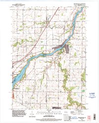
1992 Map of Wrightstown
USGS Topo · Published 1996About this map
The Fox River corridor serves as the industrial and topographic spine of this region, separating the townships of Lawrence and Rockland to the north from Kaukauna and Wrightstown in the south. The river's utility is clear at the Rapide Croche Dam and its adjacent powerplant, while the Boat Ramp and Athletic Fields indicate the transition of the riverfront into a recreational space by the 1990s.
Find a feature on this map
49 named features on this map. Tap any name to fly to it.
Don’t see what you’re looking for? This feature index may not catch every label — zoom into the map to look around manually.
Map Details
Editions of this 1992 Wrightstown Map
This is the sole edition of this map. No revisions or reprints were ever made.
Other maps of this area

1911 · Neenah
USGS Topo · 1:62,500

1954 · De Pere
USGS Topo · 1:62,500

1954 · De Pere
USGS Topo · 1:24,000

1954 · Chilton
USGS Topo · 1:62,500

1955 · Neenah
USGS Topo · 1:62,500

1955 · Appleton
USGS Topo · 1:62,500

1955 · Green Bay
USGS Topo · 1:250,000

1974 · Hilbert
USGS Topo · 1:24,000

1974 · Brillion
USGS Topo · 1:24,000

1974 · Kaukauna
USGS Topo · 1:24,000