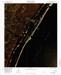
1980 Map of Wrightsville Beach
USGS Topo · Published 1985About this map
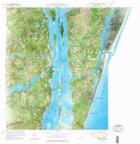
The coastal barrier islands and tidal marshes of New Hanover County are captured in this color infrared orthophotograph, showcasing the established resort community of Wrightsville Beach and the mainland residential developments of the early 1980s. The intricate network of tidal waterways, including Banks Channel and Masonboro Channel, separates the thin barrier strands from the mainland settlements of Wrightsville, Seagate, and Winter Park.
Find a feature on this map
13 named features on this map. Tap any name to fly to it.
Don’t see what you’re looking for? This feature index may not catch every label — zoom into the map to look around manually.
Map Details
Editions of this 1980 Wrightsville Beach Map
This is the sole edition of this map. No revisions or reprints were ever made.
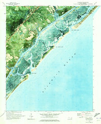
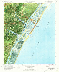
Other maps of this area

1942 · Topsail
USGS Topo · 1:62,500

1942 · Wilmington
USGS Topo · 1:62,500
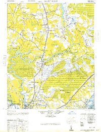
1947 · Rocky Point
USGS Topo · 1:62,500

1948 · Topsail
USGS Topo · 1:62,500

1948 · Wilmington
USGS Topo · 1:62,500

1953 · Beaufort
USGS Topo · 1:250,000

1954 · Beaufort
USGS Topo · 1:250,000
1970 · Hampstead
USGS Topo · 1:24,000
1970 · Wrightsville Beach
USGS Topo · 1:24,000
1970 · Carolina Beach
USGS Topo · 1:24,000
Featured Places
- Wilmington, NC
- Wrightsville Beach, NC
- Ogden, NC
- Masonboro, Wilmington
- Bradley Creek East Estates, Wilmington