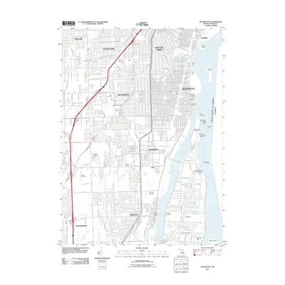
2011 Map of Wyandotte
USGS Topo · Published 2011About this map
Wyandotte and its industrial riverfront characterize this detailed survey of Wayne County's Downriver communities. The Detroit River serves as the dominant landscape feature, segmented by the Ecorse Channel, Fighting Island Channel, and Trenton Channel. These waterways surround several significant landmasses, including Fighting Island, Mamajuda Island, and the northern reaches of Grosse Ile. Navigation is a clear priority here, with the Grosse Ile North Channel Front Range Lighthouse and Fighting Island South Light marking critical passages.
Find a feature on this map
166 named features on this map. Tap any name to fly to it.
Don’t see what you’re looking for? This feature index may not catch every label — zoom into the map to look around manually.
Map Details
Editions of this 2011 Wyandotte Map
This is the sole edition of this map. No revisions or reprints were ever made.
Other maps of this area

1905 · Wayne
USGS Topo · 1:62,500

1905 · Detroit
USGS Topo · 1:62,500

1906 · Wyandotte
USGS Topo · 1:62,500

1906 · Romulus
USGS Topo · 1:62,500

1912 · Wyandotte
USGS Topo · 1:62,500

1912 · Wayne
USGS Topo · 1:62,500

1918 · Detroit
USGS Topo · 1:62,500

1924 · Detroit
USGS Topo · 1:62,500

1928 · Romulus
USGS Topo · 1:62,500

1929 · Wyandotte
USGS Topo · 1:62,500