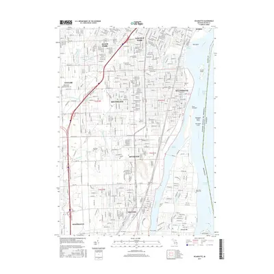
2017 Map of Wyandotte
USGS Topo · Published 2017About this map
The Detroit River and its industrial waterfront define this Downriver landscape, where the Trenton Channel separates the mainland from Grosse Ile and a series of river islands including Mud Island and Grassy Island. The urbanization of Wyandotte, Trenton, and Lincoln Park is visible through a dense grid of streets and significant industrial infrastructure like the Conrail lines that parallel the shore. This 2017 survey reveals the extensive network of drainage systems such as the Sexton and Kilfoil Drain and Frank and Poet Drain that have reshaped the hydrology of the former marshlands.
Find a feature on this map
55 named features on this map. Tap any name to fly to it.
Don’t see what you’re looking for? This feature index may not catch every label — zoom into the map to look around manually.
Map Details
Editions of this 2017 Wyandotte Map
This is the sole edition of this map. No revisions or reprints were ever made.
Other maps of this area

1905 · Wayne
USGS Topo · 1:62,500

1905 · Detroit
USGS Topo · 1:62,500

1906 · Wyandotte
USGS Topo · 1:62,500

1906 · Romulus
USGS Topo · 1:62,500

1912 · Wyandotte
USGS Topo · 1:62,500

1912 · Wayne
USGS Topo · 1:62,500

1918 · Detroit
USGS Topo · 1:62,500

1924 · Detroit
USGS Topo · 1:62,500

1928 · Romulus
USGS Topo · 1:62,500

1929 · Wyandotte
USGS Topo · 1:62,500