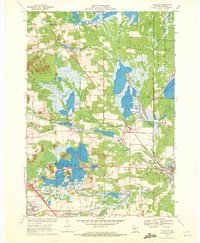
1970 Map of Wyeville
USGS Topo · Published 1972About this map
The Chicago and North Western rail corridor anchors this 1970 survey of eastern Monroe County, where the village of Wyeville and the settlement of Valley Junction serve as the primary hubs. The landscape is defined by the hydrologic network of the Lemonweir River and its South Fork, surrounded by numerous Cranberry Bogs that speak to the region's specialized agricultural heritage. To the north, the Meadow Valley State Wildlife Area occupies the lowland reaches of Meadow Valley Creek.
Find a feature on this map
30 named features on this map. Tap any name to fly to it.
Don’t see what you’re looking for? This feature index may not catch every label — zoom into the map to look around manually.
Map Details
Editions of this 1970 Wyeville Map
2 editions found
Other maps of this area

1916 · Tomah
USGS Topo · 1:62,500

1919 · Kendall
USGS Topo · 1:62,500

1921 · Kendall
USGS Topo · 1:62,500

1947 · Millston
USGS Topo · 1:62,500

1949 · Millston
USGS Topo · 1:62,500

1949 · Tomah
USGS Topo · 1:62,500

1953 · Eau Claire
USGS Topo · 1:250,000

1958 · Eau Claire
USGS Topo · 1:250,000

1958 · Wyeville
USGS Topo · 1:48,000

1958 · La Crosse
USGS Topo · 1:250,000