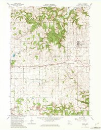
1965 Map of Wykoff
USGS Topo · Published 1982About this map
Wykoff sits as a central hub on this mid-1960s survey, defined by its position along the Chicago Milwaukee St Paul and Pacific railroad line. The landscape transitions from the agricultural plateaus of Bloomfield and Forestville townships into the deeply incised valleys of the South Branch Root River and Spring Valley Creek. The northern portion of the map is dominated by the dense wooded tracts of the Minnesota Memorial Hardwood State Forest, where terrain features like Kingsley Valley and several named springs, including Freiheit Spring and Cave Spring, highlight the region's karst-like topography. Local genealogy is well-preserved through numerous rural landmarks such as Bateman Sch and a high density of country cemeteries, including St Johns Cem and Lone Oak Cem. Small-scale industrial activity is evident in the scattered Strip Mines and several limestone Quarry sites along the river bluffs.
Find a feature on this map
39 named features on this map. Tap any name to fly to it.
Don’t see what you’re looking for? This feature index may not catch every label — zoom into the map to look around manually.
Map Details
Editions of this 1965 Wykoff Map
2 editions found
Other maps of this area

1954 · Chatfield
USGS Topo · 1:62,500

1954 · Mason City
USGS Topo · 1:250,000

1955 · Stewartville
USGS Topo · 1:62,500

1957 · Mason City
USGS Topo · 1:250,000

1958 · Mason City
USGS Topo · 1:250,000

1965 · Greenleafton
USGS Topo · 1:24,000

1965 · Wykoff
USGS Topo · 1:24,000

1965 · Spring Valley
USGS Topo · 1:24,000

1965 · Ostrander
USGS Topo · 1:24,000

1965 · Fountain
USGS Topo · 1:24,000