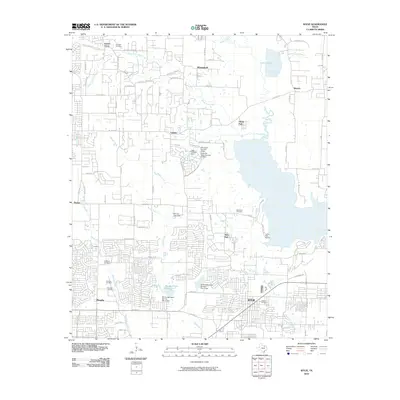
2010 Map of Wylie
USGS Topo · Published 2010About this map
Lavon Lake dominates the eastern horizon of this 2010 survey, illustrating the sophisticated water management and suburban expansion north of Dallas. The landscape is defined by the drainage systems of White Rock Creek and Muddy Creek, which feed into the large reservoir via numerous branches such as Turner Branch and Rush Creek. Local infrastructure is marked by several significant dams, including the Sies Lagos Number 5 Dam and the Soil Conservation Service Site 4 Dam, which have reshaped the hydrology to support the growing residential communities of Lucas and Wylie.
Find a feature on this map
85 named features on this map. Tap any name to fly to it.
Don’t see what you’re looking for? This feature index may not catch every label — zoom into the map to look around manually.
Map Details
Editions of this 2010 Wylie Map
This is the sole edition of this map. No revisions or reprints were ever made.
Other maps of this area

1891 · Dallas
USGS Topo · 1:125,000

1893 · Dallas
USGS Topo · 1:125,000

1912 · Rockwall
USGS Topo · 1:31,680

1919 · Royse City
USGS Topo · 1:62,500

1924 · Farmersville 3-c
USGS Topo · 1:48,000

1924 · Mc Kinney 4-d
USGS Topo · 1:48,000

1929 · McKinney
USGS Topo · 1:62,500

1930 · Farmersville
USGS Topo · 1:62,500

1954 · Dallas
USGS Topo · 1:250,000

1954 · Sherman
USGS Topo · 1:250,000