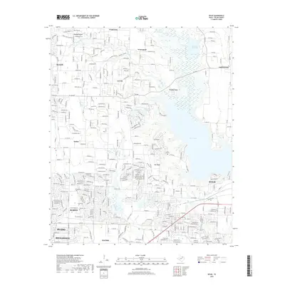
2019 Map of Wylie
USGS Topo · Published 2019About this map
Lavon Lake dominates the eastern horizon of this Collin County landscape, where suburban expansion meets the remnant traces of early North Texas settlement. Small communities such as Winningkoff and St. Paul are situated among the intricate network of creeks, including White Rock Cr, Wilson Cr, and Muddy Cr. For genealogists and local historians, the area is notably dense with small family and community burial grounds, such as Fitzhugh Cem, Moulden Cem, and Hughes Cem. These sites provide a localized anchor for the modern footprints of Wylie, Murphy, and Lucas. The transition from rural creek-side pastures to established neighborhoods is further evidenced by the complex system of county roads and named trails that bridge the gap between historic farmsteads and 21st-century residential developments.
Find a feature on this map
229 named features on this map. Tap any name to fly to it.
Don’t see what you’re looking for? This feature index may not catch every label — zoom into the map to look around manually.
Map Details
Editions of this 2019 Wylie Map
This is the sole edition of this map. No revisions or reprints were ever made.
Other maps of this area

1891 · Dallas
USGS Topo · 1:125,000

1893 · Dallas
USGS Topo · 1:125,000

1912 · Rockwall
USGS Topo · 1:31,680

1919 · Royse City
USGS Topo · 1:62,500

1924 · Farmersville 3-c
USGS Topo · 1:48,000

1924 · Mc Kinney 4-d
USGS Topo · 1:48,000

1929 · McKinney
USGS Topo · 1:62,500

1930 · Farmersville
USGS Topo · 1:62,500

1954 · Dallas
USGS Topo · 1:250,000

1954 · Sherman
USGS Topo · 1:250,000