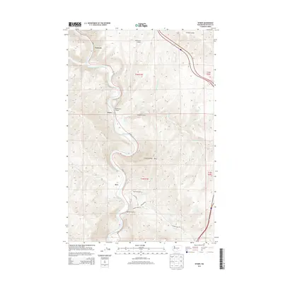
2013 Map of Wymer
USGS Topo · Published 2013About this map
The Yakima River carves a deep, winding path through this portion of Kittitas County, defining the settlement patterns of small localities like Umtanum, Wymer, and Roza. The terrain is characterized by dramatic elevation shifts, where Umtanum Ridge and the high point at Baldy overlook narrow canyons and coulees. Transportation follows the water, with Wa-821 hugging the riverbanks and connecting these isolated points of habitation.
Find a feature on this map
28 named features on this map. Tap any name to fly to it.
Don’t see what you’re looking for? This feature index may not catch every label — zoom into the map to look around manually.
Map Details
Editions of this 2013 Wymer Map
This is the sole edition of this map. No revisions or reprints were ever made.
Other maps of this area

1899 · Ellensburg
USGS Topo · 1:125,000

1901 · Ellensburg
USGS Topo · 1:125,000

1936 · Yakima East
USGS Topo · 1:48,000

1938 · Badger Pocket
USGS Topo · 1:48,000

1941 · Yakima East
USGS Topo · 1:62,500

1943 · Badger Pocket
USGS Topo · 1:62,500

1950 · Yakima
USGS Topo · 1:250,000

1953 · Pomona
USGS Topo · 1:24,000
1953 · Badger Gap
USGS Topo · 1:24,000
1953 · East Kittitas
USGS Topo · 1:24,000