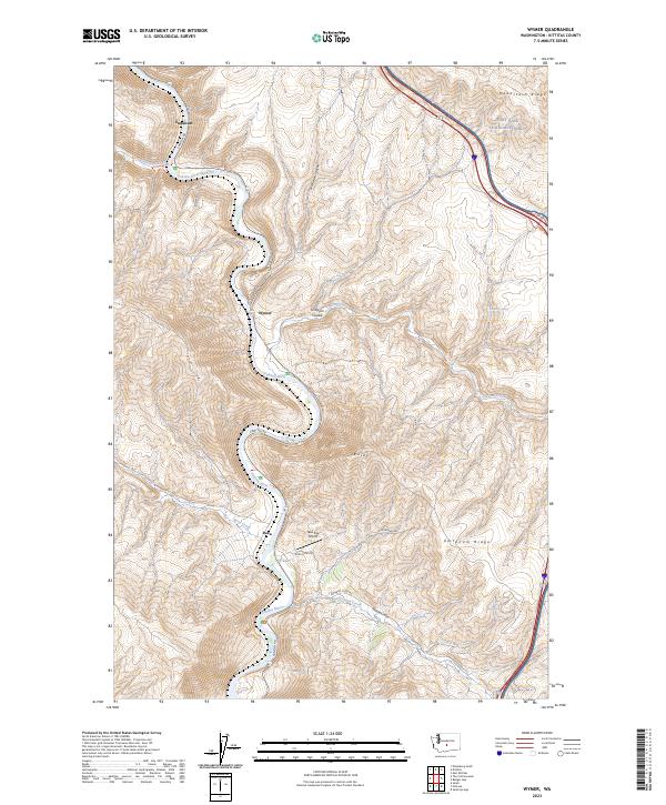
2023 Map of Wymer
USGS Topo · Published 2023About this map
The Yakima River carves a deep, winding path through this portion of Kittitas County, dictating the placement of infrastructure and small settlements like Wymer and Roza. The topography is dominated by the massive parallel formations of Manastash Ridge to the north and Umtanum Ridge to the south, creating a constrained corridor for Canyon Rd and the regional rail line. In the northeast, a portion of Joint Base Lewis-McChord extends across the high ground, while the valley floor features the small Take Five Airport near the confluence of Burbank Creek. This 2023 survey illustrates how the arid, folded landscape of the Yakima Canyon continues to focus human activity along its narrow riverbanks and spring-fed coulees such as Scorpion Coulee and McPherson Canyon.
Find a feature on this map
29 named features on this map. Tap any name to fly to it.
Don’t see what you’re looking for? This feature index may not catch every label — zoom into the map to look around manually.
Map Details
Editions of this 2023 Wymer Map
This is the sole edition of this map. No revisions or reprints were ever made.
Other maps of this area

1899 · Ellensburg
USGS Topo · 1:125,000

1901 · Ellensburg
USGS Topo · 1:125,000

1936 · Yakima East
USGS Topo · 1:48,000

1938 · Badger Pocket
USGS Topo · 1:48,000

1941 · Yakima East
USGS Topo · 1:62,500

1943 · Badger Pocket
USGS Topo · 1:62,500

1950 · Yakima
USGS Topo · 1:250,000

1953 · Pomona
USGS Topo · 1:24,000
1953 · Badger Gap
USGS Topo · 1:24,000
1953 · East Kittitas
USGS Topo · 1:24,000