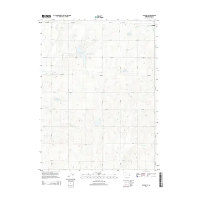
2014 Map of Wymore NE
USGS Topo · Published 2014About this map
Virginia stands as the primary settlement in this section of Gage County, situated in the northeast corner where it is served by 1st St and E Belvidere Rd. The landscape is defined by an extensive water management system along Mud Cr, characterized by a series of engineered catchments including Mud Cr Reservoir 4-8, Mud Cr Reservoir 4-5, and Mud Cr Reservoir 4-C. These structures, along with the larger Rockford Lake, illustrate the region's focus on soil conservation and water control within the prairie terrain. Genealogy researchers will find the locations of Virginia Cem and Stark Cem clearly marked, while physical landmarks like Mud Cr Dam 4-D and the winding course of Bloody Run provide essential points of reference for understanding the historical drainage and land use patterns of the area.
Find a feature on this map
35 named features on this map. Tap any name to fly to it.
Don’t see what you’re looking for? This feature index may not catch every label — zoom into the map to look around manually.
Map Details
Editions of this 2014 Wymore NE Map
This is the sole edition of this map. No revisions or reprints were ever made.
Other maps of this area

1955 · Lincoln
USGS Topo · 1:250,000

1957 · Lincoln
USGS Topo · 1:250,000

1957 · Beatrice East
USGS Topo · 1:24,000

1958 · Lincoln
USGS Topo · 1:250,000

1964 · Blue Springs
USGS Topo · 1:24,000

1965 · Crab Orchard
USGS Topo · 1:24,000

1965 · Lewiston
USGS Topo · 1:24,000
1965 · Liberty
USGS Topo · 1:24,000
1970 · Wymore
USGS Topo · 1:24,000
1970 · Barneston
USGS Topo · 1:24,000