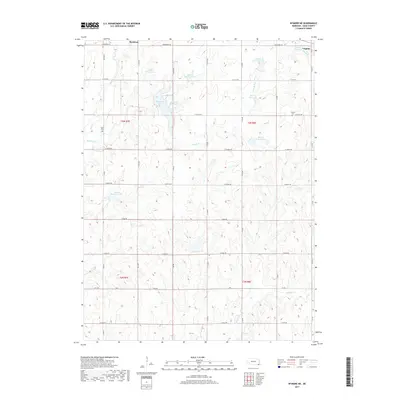
2017 Map of Wymore NE
USGS Topo · Published 2017About this map
Virginia and Rockford anchor this section of Gage County, where a complex network of agricultural water management dominates the landscape. The terrain is defined by the numerous reservoirs and dams along Mud Cr and its tributaries, including Mud Cr Reservoir 4-8, Mud Cr Reservoir 3-A, and Kuhns Reservoir. These engineered water bodies, coupled with drainages like Bloody Run and Wildcat Cr, illustrate the intensive hydrological modification required for farming on these Nebraska plains.
Find a feature on this map
41 named features on this map. Tap any name to fly to it.
Don’t see what you’re looking for? This feature index may not catch every label — zoom into the map to look around manually.
Map Details
Editions of this 2017 Wymore NE Map
This is the sole edition of this map. No revisions or reprints were ever made.
Other maps of this area

1955 · Lincoln
USGS Topo · 1:250,000

1957 · Lincoln
USGS Topo · 1:250,000

1957 · Beatrice East
USGS Topo · 1:24,000

1958 · Lincoln
USGS Topo · 1:250,000

1964 · Blue Springs
USGS Topo · 1:24,000

1965 · Crab Orchard
USGS Topo · 1:24,000

1965 · Lewiston
USGS Topo · 1:24,000
1965 · Liberty
USGS Topo · 1:24,000
1970 · Wymore
USGS Topo · 1:24,000
1970 · Barneston
USGS Topo · 1:24,000