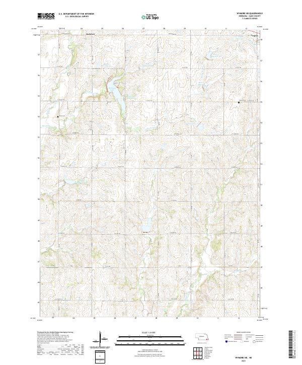
2021 Map of Wymore NE
USGS Topo · Published 2021About this map
Rockford Lake and its surrounding watershed define this landscape in Gage County, where a complex network of reservoirs manages the flow of Mud Cr and its tributaries. The terrain is characterized by the organized section lines of the Public Land Survey System, with many local routes such as E Belvidere Rd and E Osage Rd following these historical boundaries. Small settlements and local landmarks provide anchor points for genealogical research, particularly the areas around Rockford and Virginia.
Find a feature on this map
30 named features on this map. Tap any name to fly to it.
Don’t see what you’re looking for? This feature index may not catch every label — zoom into the map to look around manually.
Map Details
Editions of this 2021 Wymore NE Map
This is the sole edition of this map. No revisions or reprints were ever made.
Other maps of this area

1955 · Lincoln
USGS Topo · 1:250,000

1957 · Lincoln
USGS Topo · 1:250,000

1957 · Beatrice East
USGS Topo · 1:24,000

1958 · Lincoln
USGS Topo · 1:250,000

1964 · Blue Springs
USGS Topo · 1:24,000

1965 · Crab Orchard
USGS Topo · 1:24,000

1965 · Lewiston
USGS Topo · 1:24,000
1965 · Liberty
USGS Topo · 1:24,000
1970 · Wymore
USGS Topo · 1:24,000
1970 · Barneston
USGS Topo · 1:24,000