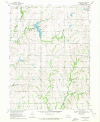
1970 Map of Wymore NE
USGS Topo · Published 1972About this map
Rockford Lake sits at the heart of this Gage County landscape, its irregular shoreline providing a central landmark for the surrounding townships of Rockford, Sherman, and Blue Springs. The map documents a rural Nebraska environment in the early 1970s, where small settlements like Rockford and Virginia serve as local hubs. An Old Railroad Grade in the northwest corner traces the path of former transport lines, signaling the shifting infrastructure of the Great Plains.
Find a feature on this map
19 named features on this map. Tap any name to fly to it.
Don’t see what you’re looking for? This feature index may not catch every label — zoom into the map to look around manually.
Map Details
Editions of this 1970 Wymore NE Map
This is the sole edition of this map. No revisions or reprints were ever made.
Other maps of this area

1955 · Lincoln
USGS Topo · 1:250,000

1957 · Lincoln
USGS Topo · 1:250,000

1957 · Beatrice East
USGS Topo · 1:24,000

1958 · Lincoln
USGS Topo · 1:250,000

1964 · Blue Springs
USGS Topo · 1:24,000

1965 · Crab Orchard
USGS Topo · 1:24,000

1965 · Lewiston
USGS Topo · 1:24,000
1965 · Liberty
USGS Topo · 1:24,000
1970 · Wymore
USGS Topo · 1:24,000
1970 · Barneston
USGS Topo · 1:24,000