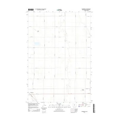
2014 Map of Wyndmere SE
USGS Topo · Published 2014About this map
Wyndmere occupies the southwestern corner of this Richland County landscape, where the local grid of agricultural roads meets the primary east-west corridor of Nd-13. The terrain is characterized by a high density of small depressions and seasonal water bodies typical of the prairie pothole region, interspersed with a rigid network of section-line roads like 160th Ave SE and 75th St SE. Aviation is a visible part of the local infrastructure, with both Sanden Airport in the north and the Hager Strip Airport to the south serving the farming community. Genealogists may find interest in the Peace Cem, located just off the highway near the eastern edge of the quadrangle. The map captures the quiet, organized layout of this rural North Dakota township, where transportation is funneled through specialized routes such as Overpass Ln and Red River Ave.
Find a feature on this map
23 named features on this map. Tap any name to fly to it.
Don’t see what you’re looking for? This feature index may not catch every label — zoom into the map to look around manually.
Map Details
Editions of this 2014 Wyndmere SE Map
This is the sole edition of this map. No revisions or reprints were ever made.
Other maps of this area

1904 · Wahpeton
USGS Topo · 1:125,000

1907 · Wyndmere
USGS Topo · 1:125,000

1953 · Fargo
USGS Topo · 1:250,000

1956 · Fargo
USGS Topo · 1:250,000

1959 · Wyndmere NE
USGS Topo · 1:24,000

1959 · Mooreton NW
USGS Topo · 1:24,000

1960 · Wyndmere
USGS Topo · 1:24,000

1960 · Wyndmere NW
USGS Topo · 1:24,000

1960 · Mooreton West
USGS Topo · 1:24,000

1960 · Wyndmere SE
USGS Topo · 1:24,000