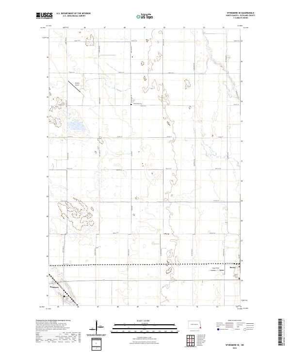
2024 Map of Wyndmere SE
USGS Topo · Published 2024About this map
Wyndmere and Barney anchor the southern reaches of this Richland County landscape, where the flat agricultural terrain is organized by a precise grid of sectional roads. The township lines of t132n r51w and t132n r50w define the southern border, while the area is marked by several local burial sites that speak to the region's heritage, including Saint John's Cem near Wyndmere and the Peace Lutheran Cem on the outskirts of Barney. Aviation remains a visible part of the local infrastructure, with both the Sanden Airport and Hager Strip appearing in the northern and eastern portions of the quadrangle. The map illustrates a typical North Dakota prairie layout, where small wetland pockets are interspersed between the long stretches of numbered roads like 72nd St SE and 160th Ave SE.
Find a feature on this map
32 named features on this map. Tap any name to fly to it.
Don’t see what you’re looking for? This feature index may not catch every label — zoom into the map to look around manually.
Map Details
Editions of this 2024 Wyndmere SE Map
This is the sole edition of this map. No revisions or reprints were ever made.
Other maps of this area

1904 · Wahpeton
USGS Topo · 1:125,000

1907 · Wyndmere
USGS Topo · 1:125,000

1953 · Fargo
USGS Topo · 1:250,000

1956 · Fargo
USGS Topo · 1:250,000

1959 · Wyndmere NE
USGS Topo · 1:24,000

1959 · Mooreton NW
USGS Topo · 1:24,000

1960 · Wyndmere
USGS Topo · 1:24,000

1960 · Wyndmere NW
USGS Topo · 1:24,000

1960 · Mooreton West
USGS Topo · 1:24,000

1960 · Wyndmere SE
USGS Topo · 1:24,000