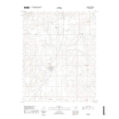
2018 Map of Wynona
USGS Topo · Published 2018About this map
Wynona serves as the central hub of this Osage County landscape, situated along the northern reaches of the t24n r9e township. The town grid is clearly defined, with streets such as 1st St and 5th St surrounding the core area. To the northeast, the smaller settlement of Pershing occupies a high point between the drainages of Saucy Calf Creek and Coohee Creek. This region of Oklahoma is characterized by numerous small watercourses and prominent topographic features like Wooster Mound, which rises north of town.
Find a feature on this map
57 named features on this map. Tap any name to fly to it.
Don’t see what you’re looking for? This feature index may not catch every label — zoom into the map to look around manually.
Map Details
Editions of this 2018 Wynona Map
This is the sole edition of this map. No revisions or reprints were ever made.
Other maps of this area

1906 · Nelagoney
USGS Topo · 1:24,000

1909 · Pawhuska
USGS Topo · 1:125,000

1910 · Pawhuska
USGS Topo · 1:125,000

1912 · Hominy
USGS Topo · 1:125,000

1915 · Hominy
USGS Topo · 1:125,000

1915 · Hominy
USGS Topo · 1:62,500

1955 · Enid
USGS Topo · 1:250,000

1958 · Enid
USGS Topo · 1:250,000

1960 · Nelagoney
USGS Topo · 1:24,000

1960 · Pawhuska
USGS Topo · 1:24,000