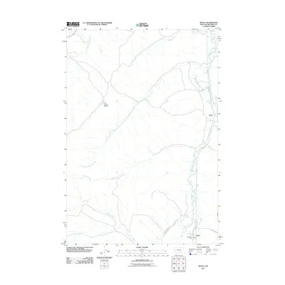
2011 Map of Wyola
USGS Topo · Published 2011About this map
The Little Bighorn River flows through this corner of Big Horn County, defining the agricultural and settlement patterns of the region. The community of Wyola sits at the southern end of the sheet, where the Wyola Post Office and local thoroughfares like Little Horn Ave anchor the small town. Further north along the river valley, the settlement of Spear marks a distinct point of habitation in an otherwise expansive landscape of creek drainages and irrigation works.
Find a feature on this map
18 named features on this map. Tap any name to fly to it.
Don’t see what you’re looking for? This feature index may not catch every label — zoom into the map to look around manually.
Map Details
Editions of this 2011 Wyola Map
This is the sole edition of this map. No revisions or reprints were ever made.
Other maps of this area

1894 · Rosebud
USGS Topo · 1:125,000

1894 · St. Xavier
USGS Topo · 1:125,000

1901 · Rosebud
USGS Topo · 1:125,000

1901 · St. Xavier
USGS Topo · 1:125,000

1954 · Hardin
USGS Topo · 1:250,000

1957 · Hardin
USGS Topo · 1:250,000

1958 · Hardin
USGS Topo · 1:250,000

1960 · Schick Ranch
USGS Topo · 1:24,000
1967 · Wyola
USGS Topo · 1:24,000
1967 · Wyola NE
USGS Topo · 1:24,000