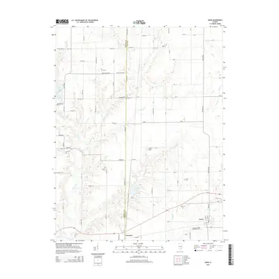
2015 Map of Xenia
USGS Topo · Published 2015About this map
Xenia and the smaller settlement of Greendale anchor this 2015 study of the border between Marion and Clay counties. The landscape is defined by the winding course of the Skillet Fork and its numerous tributaries, including Pickle Creek and Conners Branch. This survey is particularly valuable for genealogists, as it documents a high concentration of rural burial sites such as Edwards Family Cem, Salem Cem, and the Independent Order of Oddfellows Cemetery. These features, along with Smith Cem and Phillips Cem to the north, offer a clear picture of the historical community distribution across the township. The drainage patterns of Nickolson Creek and the presence of Greendale Lake illustrate the hydrology that influenced local development and road placement throughout the era.
Find a feature on this map
63 named features on this map. Tap any name to fly to it.
Don’t see what you’re looking for? This feature index may not catch every label — zoom into the map to look around manually.
Map Details
Editions of this 2015 Xenia Map
This is the sole edition of this map. No revisions or reprints were ever made.
Other maps of this area

1934 · Salem
USGS Topo · 1:62,500

1938 · Salem
USGS Topo · 1:62,500

1945 · Kinmundy
USGS Topo · 1:62,500

1947 · Kinmundy
USGS Topo · 1:62,500

1952 · Xenia
USGS Topo · 1:62,500

1956 · Edgewood
USGS Topo · 1:62,500

1958 · Belleville
USGS Topo · 1:250,000

1962 · Belleville
USGS Topo · 1:250,000

1965 · Iuka
USGS Topo · 1:24,000
1965 · Omega
USGS Topo · 1:24,000