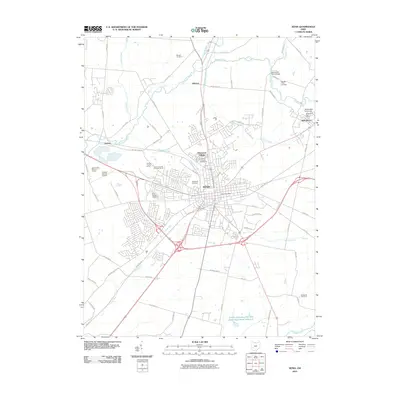
2010 Map of Xenia
USGS Topo · Published 2010About this map
Xenia serves as the central hub of this 2010 topographic record, where the convergence of the Ohio-Erie Trl and various regional routes defines the landscape. The city's residential and civic footprint is well-documented, featuring the Xenia Post Office, the Greene County Fairgrounds, and the expansive Woodland Cemetery. To the northeast, the academic grounds of Wilberforce University and the Wilberforce Post Office mark a significant cultural and educational center.
Find a feature on this map
72 named features on this map. Tap any name to fly to it.
Don’t see what you’re looking for? This feature index may not catch every label — zoom into the map to look around manually.
Map Details
Editions of this 2010 Xenia Map
This is the sole edition of this map. No revisions or reprints were ever made.
Other maps of this area

1904 · Springfield
USGS Topo · 1:62,500

1904 · Dayton
USGS Topo · 1:62,500

1906 · Dayton
USGS Topo · 1:62,500

1906 · Springfield
USGS Topo · 1:62,500

1913 · Waynesville
USGS Topo · 1:62,500

1915 · Waynesville
USGS Topo · 1:62,500

1917 · Xenia
USGS Topo · 1:62,500

1947 · Columbus
USGS Topo · 1:250,000

1953 · Cincinnati
USGS Topo · 1:250,000

1954 · Clifton
USGS Topo · 1:24,000