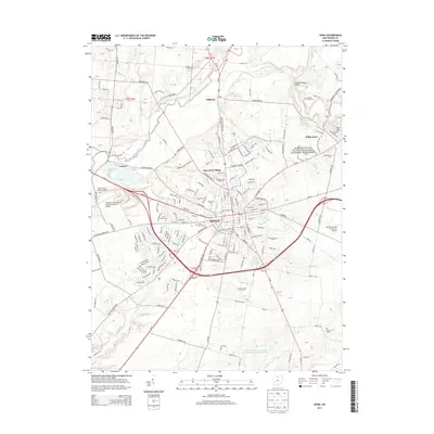
2013 Map of Xenia
USGS Topo · Published 2013About this map
The city of Xenia serves as the hub of this Greene County landscape, where the confluence of regional history and academic growth is clearly mapped. To the northeast, the presence of Wilberforce Univ and Central State Univ highlights the area's long-standing educational importance, while the Charles Young Buffalo Soldiers National Monument preserves a significant civil rights and military legacy. The physical landscape is defined by the Little Miami River and numerous tributaries such as Massies Creek and Glady Run. Genealogists will find a high density of burial sites including Woodland Cem, Saint Brigids Cem, and the more remote McDaniel Cem. The transition from the urban Xenia Towne Sq to outlying settlements like Oldtown and Trebein illustrates the enduring settlement patterns of southwestern Ohio.
Find a feature on this map
188 named features on this map. Tap any name to fly to it.
Don’t see what you’re looking for? This feature index may not catch every label — zoom into the map to look around manually.
Map Details
Editions of this 2013 Xenia Map
This is the sole edition of this map. No revisions or reprints were ever made.
Other maps of this area

1904 · Springfield
USGS Topo · 1:62,500

1904 · Dayton
USGS Topo · 1:62,500

1906 · Dayton
USGS Topo · 1:62,500

1906 · Springfield
USGS Topo · 1:62,500

1913 · Waynesville
USGS Topo · 1:62,500

1915 · Waynesville
USGS Topo · 1:62,500

1917 · Xenia
USGS Topo · 1:62,500

1947 · Columbus
USGS Topo · 1:250,000

1953 · Cincinnati
USGS Topo · 1:250,000

1954 · Clifton
USGS Topo · 1:24,000