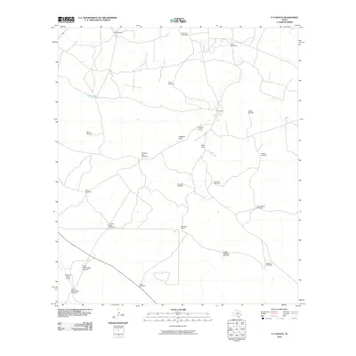
2010 Map of Y O Ranch
USGS Topo · Published 2010About this map
Y O Ranch serves as the central hub of this Hill Country landscape, where the infrastructure of Texas ranching is meticulously documented through a network of specialized water sources. The terrain is defined by a high density of named windmills, such as Bee Cave Windmill, Double Gates Windmill, and Tecolote Windmill, which signify the vital importance of groundwater management in this environment. Transportation and land use are further marked by private aviation facilities, including the Y O Ranch Airport and West Kerr Ranch Airport, reflecting the modernization of large-scale landholdings.
Find a feature on this map
26 named features on this map. Tap any name to fly to it.
Don’t see what you’re looking for? This feature index may not catch every label — zoom into the map to look around manually.
Map Details
Editions of this 2010 Y O Ranch Map
This is the sole edition of this map. No revisions or reprints were ever made.
Other maps of this area

1932 · Junction
USGS Topo · 1:62,500

1954 · Llano
USGS Topo · 1:250,000

1955 · Llano
USGS Topo · 1:250,000

1956 · Llano
USGS Topo · 1:250,000

1963 · Garven Store
USGS Topo · 1:24,000

1963 · Y O Ranch
USGS Topo · 1:24,000

1964 · Boneyard Draw
USGS Topo · 1:24,000

1964 · Live Oak Ranch
USGS Topo · 1:24,000
1971 · Earwood Creek
USGS Topo · 1:24,000
1971 · Horse Camp Waterhole
USGS Topo · 1:24,000