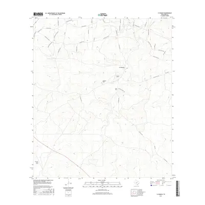
2016 Map of Y O Ranch
USGS Topo · Published 2016About this map
Y O Ranch occupies the heart of this Texas Hill Country terrain, defined by a complex network of private ranch roads and aviation access. The landscape is marked by prominent topographic features such as Gobblers Knob and Deer Park, alongside the rugged drainage of Deadman Gulch. Aviation is central to the area's infrastructure, anchored by the Y O Ranch Airport and the West Kerr Ranch Airport. The name Camino Real Rd suggests a historical continuity of travel through these uplands, while small water sources like Bundy Tank and the seasonal Johnson Fork illustrate the essential nature of water management in this arid environment. The road nomenclature, including Indian Mound Rd Nw and Comanche Trails Rd, reflects the deep cultural layers of the region.
Find a feature on this map
40 named features on this map. Tap any name to fly to it.
Don’t see what you’re looking for? This feature index may not catch every label — zoom into the map to look around manually.
Map Details
Editions of this 2016 Y O Ranch Map
This is the sole edition of this map. No revisions or reprints were ever made.
Other maps of this area

1932 · Junction
USGS Topo · 1:62,500

1954 · Llano
USGS Topo · 1:250,000

1955 · Llano
USGS Topo · 1:250,000

1956 · Llano
USGS Topo · 1:250,000

1963 · Garven Store
USGS Topo · 1:24,000

1963 · Y O Ranch
USGS Topo · 1:24,000

1964 · Boneyard Draw
USGS Topo · 1:24,000

1964 · Live Oak Ranch
USGS Topo · 1:24,000
1971 · Earwood Creek
USGS Topo · 1:24,000
1971 · Horse Camp Waterhole
USGS Topo · 1:24,000