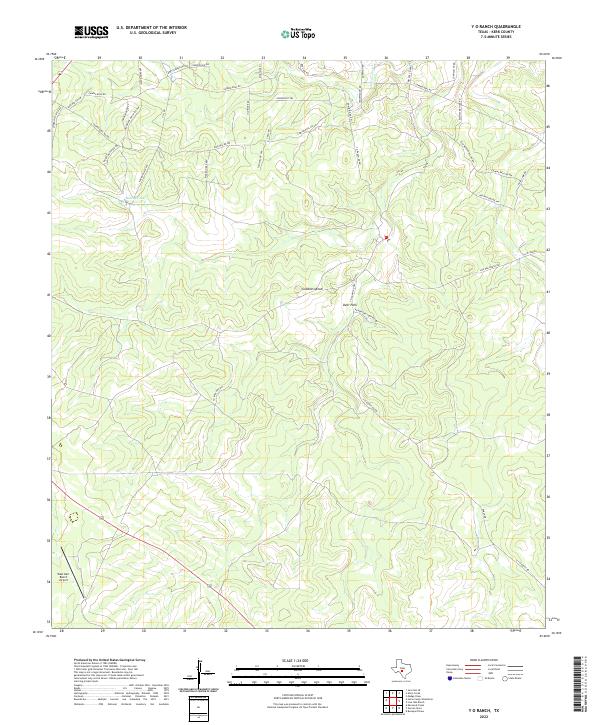
2022 Map of Y O Ranch
USGS Topo · Published 2022About this map
The hills and canyons of the Texas Hill Country define this landscape, where ranching heritage and aviation meet. The West Kerr Ranch Airport serves this secluded corner of Kerr County, situated among high ridges like Gobblers Knob. The complex network of ranch roads and trails, such as Goodnight Trl and Indian Mound Rd, suggests a territory deeply tied to historic cattle routes and modern land management.
Find a feature on this map
41 named features on this map. Tap any name to fly to it.
Don’t see what you’re looking for? This feature index may not catch every label — zoom into the map to look around manually.
Map Details
Editions of this 2022 Y O Ranch Map
This is the sole edition of this map. No revisions or reprints were ever made.
Other maps of this area

1932 · Junction
USGS Topo · 1:62,500

1954 · Llano
USGS Topo · 1:250,000

1955 · Llano
USGS Topo · 1:250,000

1956 · Llano
USGS Topo · 1:250,000

1963 · Garven Store
USGS Topo · 1:24,000

1963 · Y O Ranch
USGS Topo · 1:24,000

1964 · Boneyard Draw
USGS Topo · 1:24,000

1964 · Live Oak Ranch
USGS Topo · 1:24,000
1971 · Earwood Creek
USGS Topo · 1:24,000
1971 · Horse Camp Waterhole
USGS Topo · 1:24,000