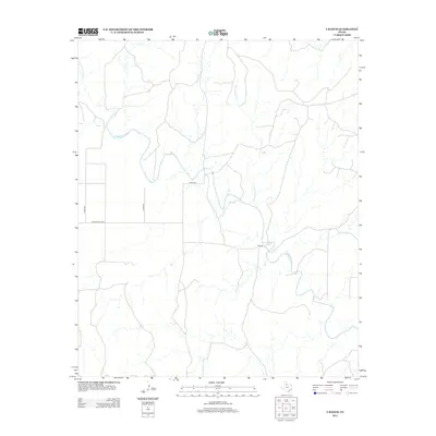
2012 Map of Y Ranch
USGS Topo · Published 2012About this map
Y Ranch serves as the primary focal point of this rural Cottle County landscape, situated near a southern bend of the N Wichita River. The terrain is defined by a dendritic network of drainage systems, including Coon Hollow Cr and Cottonwood Cr, which carve through the plains of West Texas. Settlement is sparse, with human activity primarily indicated by a grid of county roads such as Co Rd-489 and Co Rd-493. The infrastructure reflects the region's long-standing ranching economy, where transportation is channeled through corridors like Ranch Road 1038. The relationship between the meandering E Cottonwood Cr and these straight-line road boundaries illustrates the intersection of natural topography and organized land management in the early 21st century.
Find a feature on this map
9 named features on this map. Tap any name to fly to it.
Don’t see what you’re looking for? This feature index may not catch every label — zoom into the map to look around manually.
Map Details
Editions of this 2012 Y Ranch Map
This is the sole edition of this map. No revisions or reprints were ever made.
Other maps of this area

1932 · Vivian
USGS Topo · 1:62,500

1954 · Lubbock
USGS Topo · 1:250,000

1954 · Plainview
USGS Topo · 1:250,000

1954 · Wichita Falls
USGS Topo · 1:250,000

1955 · Lawton
USGS Topo · 1:250,000

1958 · Wichita Falls
USGS Topo · 1:250,000

1958 · Plainview
USGS Topo · 1:250,000

1960 · Teacup Mountain
USGS Topo · 1:62,500

1966 · Chalk SW
USGS Topo · 1:24,000

1966 · Big Four Ranch
USGS Topo · 1:24,000