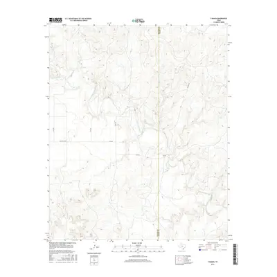
2016 Map of Y Ranch
USGS Topo · Published 2016About this map
The North Wichita River meanders through the arid breaks of West Texas, carving a complex network of drainage basins including Coon Hollow Cr and Cottonwood Cr. This 2016 survey captures a landscape defined by large-scale ranching operations, centered on the Y Ranch which sits near the dividing line between Cottle and Foard counties. The region's transport network is sparse, consisting primarily of rural routes like Fm 1038 and Ranch Rd 1038, along with unnamed ranch roads that traverse the high plateaus and river bottoms. The topography reveals the stark, eroded character of the Rolling Plains, where elevation shifts rapidly between the river valley and the surrounding uplands. This map serves as a contemporary record of land use in a region where geography and the cattle industry have long dictated the pattern of human presence.
Find a feature on this map
13 named features on this map. Tap any name to fly to it.
Don’t see what you’re looking for? This feature index may not catch every label — zoom into the map to look around manually.
Map Details
Editions of this 2016 Y Ranch Map
This is the sole edition of this map. No revisions or reprints were ever made.
Other maps of this area

1932 · Vivian
USGS Topo · 1:62,500

1954 · Lubbock
USGS Topo · 1:250,000

1954 · Plainview
USGS Topo · 1:250,000

1954 · Wichita Falls
USGS Topo · 1:250,000

1955 · Lawton
USGS Topo · 1:250,000

1958 · Wichita Falls
USGS Topo · 1:250,000

1958 · Plainview
USGS Topo · 1:250,000

1960 · Teacup Mountain
USGS Topo · 1:62,500

1966 · Chalk SW
USGS Topo · 1:24,000

1966 · Big Four Ranch
USGS Topo · 1:24,000