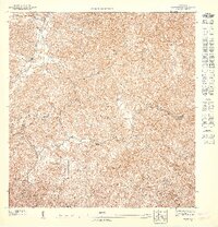
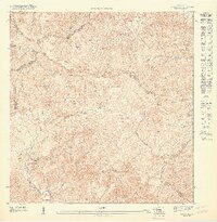
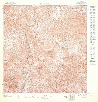
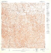
1947 Map of Yabucoa NO
USGS Topo · Published 1948About this map
Escuela La Aldea stands as a central landmark in this interior landscape of southeast Puerto Rico during the 1940s. The terrain is defined by a complex network of watercourses carving through the hills, where the Municipio de San Lorenzo and Municipio de Yabucoa boundaries meet. Significant drainage systems such as the Río Grande de Loíza and the Río Guayanés illustrate the natural irrigation that sustained this rural region's agriculture and settlement patterns. The topography is meticulously detailed, showing the intricate ridges and valleys that separated local communities. Numerous small streams, including Quebrada Lajas, Quebrada Arena, and Quebrada Verraco, underscore the importance of water access for the scattered homesteads and small-scale farms that characterized the area prior to mid-century modernization.
Find a feature on this map
14 named features on this map. Tap any name to fly to it.
Don’t see what you’re looking for? This feature index may not catch every label — zoom into the map to look around manually.
Map Details
Editions of this 1947 Yabucoa NO Map
This is the sole edition of this map. No revisions or reprints were ever made.
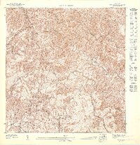
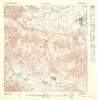
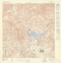
Other maps of this area

1946 · Patillas
USGS Topo · 1:30,000

1946 · Juncos
USGS Topo · 1:30,000

1946 · Yabucoa
USGS Topo · 1:30,000

1946 · Caguas
USGS Topo · 1:30,000
1947 · Yabucoa SO
USGS Topo · 1:10,000
1947 · Yabucoa SE
USGS Topo · 1:10,000
1947 · Patillas SE
USGS Topo · 1:10,000
1947 · Patillas NE
USGS Topo · 1:10,000
1947 · Juncos SO
USGS Topo · 1:10,000
1947 · Juncos SE
USGS Topo · 1:10,000
Featured Places
- Quebrada Honda, San Lorenzo
- Calabazas, Yabucoa
- Quebrada Arenas, San Lorenzo
- Espino, San Lorenzo
- Puerto Rico