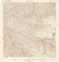
1946 Map of Yabucoa
USGS Topo · Published 1946About this map
The coastal sugar-producing landscape of southeastern Puerto Rico is anchored here by the Central Roig and Central Columbia sugar mills. Located in the fertile Valle de Yabucoa, these industrial centers are surrounded by labor-oriented settlements such as Colonia Laura and Colonia Garonne. The town of Yabucoa sits at the edge of this agricultural basin, where the Río Guayanés and Caño de Santiago drain into the coastal lowlands.
Find a feature on this map
42 named features on this map. Tap any name to fly to it.
Don’t see what you’re looking for? This feature index may not catch every label — zoom into the map to look around manually.
Map Details
Editions of this 1946 Yabucoa Map
3 editions found
Other maps of this area

1945 · Punta Tuna
USGS Topo · 1:30,000

1946 · Patillas
USGS Topo · 1:30,000

1946 · Humacao
USGS Topo · 1:30,000

1946 · Punta Guayanes
USGS Topo · 1:30,000

1946 · Juncos
USGS Topo · 1:30,000

1946 · Yabucoa
USGS Topo · 1:30,000

1946 · Guayama
USGS Topo · 1:30,000

1946 · Caguas
USGS Topo · 1:30,000
1947 · Humacao SO
USGS Topo · 1:10,000

1947 · Yabucoa SO
USGS Topo · 1:10,000