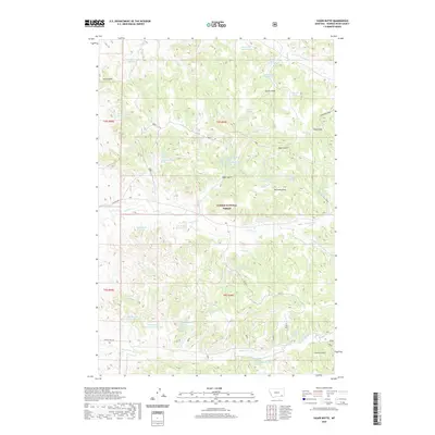
2020 Map of Yager Butte
USGS Topo · Published 2020About this map
Custer National Forest dominates this section of Powder River County, where the high-plains terrain is marked by a network of seasonal water sources and named landmarks. The namesake Yager Butte and nearby Chimney Rock rise above a landscape defined by significant drainage systems such as Tenmile Creek and Yager Creek. The distribution of water resources is a critical feature of this ranching and forest environment, with numerous man-made structures like Shorty Cr Reservoir, Two Buck Reservoir, and Cloudburst Reservoir indicating the importance of water management in this arid region. Named draws and gulches, including Nutter Draw and Jacobs Gulch, provide a window into the local topography used by early residents and forest managers. Remote access is provided by unpaved routes such as Ten Mile Rd and Fifteen Mile Rd, connecting the scattered springs like Harriet Spring Number One and McBride Spring across the rolling high country.
Find a feature on this map
55 named features on this map. Tap any name to fly to it.
Don’t see what you’re looking for? This feature index may not catch every label — zoom into the map to look around manually.
Map Details
Editions of this 2020 Yager Butte Map
This is the sole edition of this map. No revisions or reprints were ever made.
Other maps of this area

1954 · Hardin
USGS Topo · 1:250,000

1954 · Ekalaka
USGS Topo · 1:250,000

1956 · Ekalaka
USGS Topo · 1:250,000

1957 · Hardin
USGS Topo · 1:250,000

1958 · Ekalaka
USGS Topo · 1:250,000

1958 · Hardin
USGS Topo · 1:250,000

1965 · Ekalaka
USGS Topo · 1:250,000

1966 · Goodspeed Butte
USGS Topo · 1:24,000

1966 · Coleman Draw
USGS Topo · 1:24,000

1966 · Home Creek Butte
USGS Topo · 1:24,000