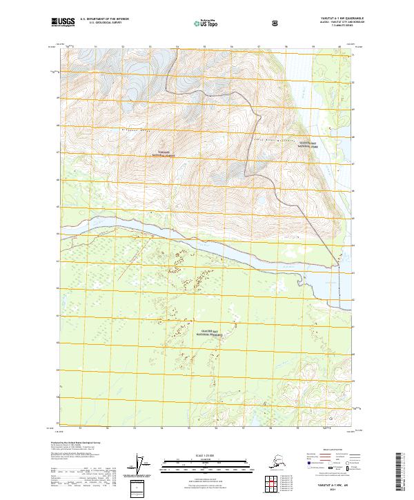
2021 Map of Yakutat A-1 NW
USGS Topo · Published 2021About this map
Glacier Bay National Park and the Glacier Bay National Preserve meet along this remote stretch of the Alaska coast, where the glacial landscape is defined by the massive drainage of the Alsek River. The river's path is heavily braided, feeding into the expansive Alsek Lake and creating complex water features like Cabin Slough. To the north, the terrain rises sharply into the Brabazon Range and the Saint Elias Mountains, highlighting the transition from river delta to high alpine environment.
Find a feature on this map
15 named features on this map. Tap any name to fly to it.
Don’t see what you’re looking for? This feature index may not catch every label — zoom into the map to look around manually.
Map Details
Editions of this 2021 Yakutat A-1 NW Map
This is the sole edition of this map. No revisions or reprints were ever made.
Other maps of this area

1951 · Yakutat
USGS Topo · 1:250,000

1959 · Yakutat A-1
USGS Topo · 1:63,360

1959 · Yakutat A-2
USGS Topo · 1:63,360

1959 · Yakutat B-2
USGS Topo · 1:63,360

1959 · Yakutat B-1
USGS Topo · 1:63,360

1959 · Yakutat
USGS Topo · 1:250,000

1997 · Yakutat B-1
USGS Topo · 1:63,360
2017 · Yakutat A-1 NW
USGS Topo · 1:25,000
2017 · Yakutat A-1 SW
USGS Topo · 1:25,000
2017 · Yakutat A-2 NE
USGS Topo · 1:25,000