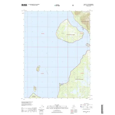
2017 Map of Yakutat C-5 NE
USGS Topo · Published 2017About this map
Knight Island and its smaller neighbors dominate this coastal survey of the eastern shores of Yakutat Bay. The landmasses within the Tongass National Forest are punctuated by a series of named islands, including Neeg Island and Tla-xagh Island, which stand as topographical high points above the waterline. The mainland coast is defined by deep inlets such as Humpback Cove and the prominent Kooisk Point.
Find a feature on this map
19 named features on this map. Tap any name to fly to it.
Don’t see what you’re looking for? This feature index may not catch every label — zoom into the map to look around manually.
Map Details
Editions of this 2017 Yakutat C-5 NE Map
This is the sole edition of this map. No revisions or reprints were ever made.
Other maps of this area

1951 · Yakutat
USGS Topo · 1:250,000

1959 · Yakutat C-5
USGS Topo · 1:63,360

1959 · Yakutat D-4
USGS Topo · 1:63,360

1959 · Yakutat C-4
USGS Topo · 1:63,360

1959 · Yakutat D-5
USGS Topo · 1:63,360

1959 · Yakutat
USGS Topo · 1:250,000

1987 · Yakutat C-4 SW
USGS Topo · 1:25,000
1987 · Yakutat C-5 SE
USGS Topo · 1:25,000
1987 · Yakutat C-5 SW
USGS Topo · 1:25,000
1996 · Yakutat C-5
USGS Topo · 1:63,360