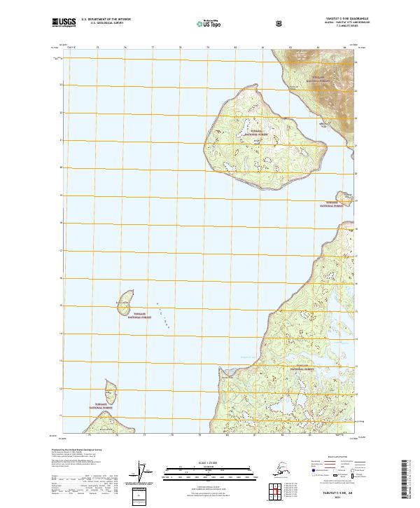
2021 Map of Yakutat C-5 NE
USGS Topo · Published 2021About this map
Knight Island and its smaller neighbors, Nees Island and Tla-xagh Island, dominate this coastal stretch of the Tongass National Forest. The landscape is defined by the transition from the marine waters of the Pacific to the rising peaks of the Saint Elias Mountains, including Mt Hoorts in the northeast. Navigation and geography are marked by prominent coastal features such as Punta de Pineda and Kooisk Point, which frame the entrance to Humpback Cove. Further inland, the hydrology includes Lake Redfield and the W Fork Situk River, indicating the complex drainage patterns common to this glaciated region. Smaller islands like Kruvoi Island, Otmeloi Island, and Kriwoi Island dot the near-shore waters, illustrating the fragmented coastline of the Yakutat City and Borough area.
Find a feature on this map
18 named features on this map. Tap any name to fly to it.
Don’t see what you’re looking for? This feature index may not catch every label — zoom into the map to look around manually.
Map Details
Editions of this 2021 Yakutat C-5 NE Map
This is the sole edition of this map. No revisions or reprints were ever made.
Other maps of this area

1951 · Yakutat
USGS Topo · 1:250,000

1959 · Yakutat C-5
USGS Topo · 1:63,360

1959 · Yakutat D-4
USGS Topo · 1:63,360

1959 · Yakutat C-4
USGS Topo · 1:63,360

1959 · Yakutat D-5
USGS Topo · 1:63,360

1959 · Yakutat
USGS Topo · 1:250,000

1987 · Yakutat C-4 SW
USGS Topo · 1:25,000
1987 · Yakutat C-5 SE
USGS Topo · 1:25,000
1987 · Yakutat C-5 SW
USGS Topo · 1:25,000
1996 · Yakutat C-5
USGS Topo · 1:63,360