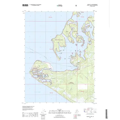
2017 Map of Yakutat C-5 SW
USGS Topo · Published 2017About this map
Yakutat serves as the focal point of this coastal landscape, situated where the shoreline meets the vast Gulf of Alaska. The settlement is intricately connected to its maritime surroundings by roads such as Mallott Avenue and Ridge Road, which lead toward the complex waterways of Monti Bay and Yakutat Roads. The terrain is defined by a dense archipelago and fragmented peninsulae, notably Khantaak Island and the expansive Phipps Peninsula.
Find a feature on this map
58 named features on this map. Tap any name to fly to it.
Don’t see what you’re looking for? This feature index may not catch every label — zoom into the map to look around manually.
Map Details
Editions of this 2017 Yakutat C-5 SW Map
This is the sole edition of this map. No revisions or reprints were ever made.
Other maps of this area

1951 · Yakutat
USGS Topo · 1:250,000

1959 · Yakutat B-5
USGS Topo · 1:63,360

1959 · Yakutat C-5
USGS Topo · 1:63,360

1959 · Yakutat
USGS Topo · 1:250,000
1985 · Yakutat C-6
USGS Topo · 1:63,360
1987 · Yakutat C-5 SE
USGS Topo · 1:25,000
1987 · Yakutat B-5 NE
USGS Topo · 1:25,000
1987 · Yakutat C-5 SW
USGS Topo · 1:25,000
1996 · Yakutat C-5
USGS Topo · 1:63,360
2017 · Yakutat C-5 NE
USGS Topo · 1:25,000